Map
-
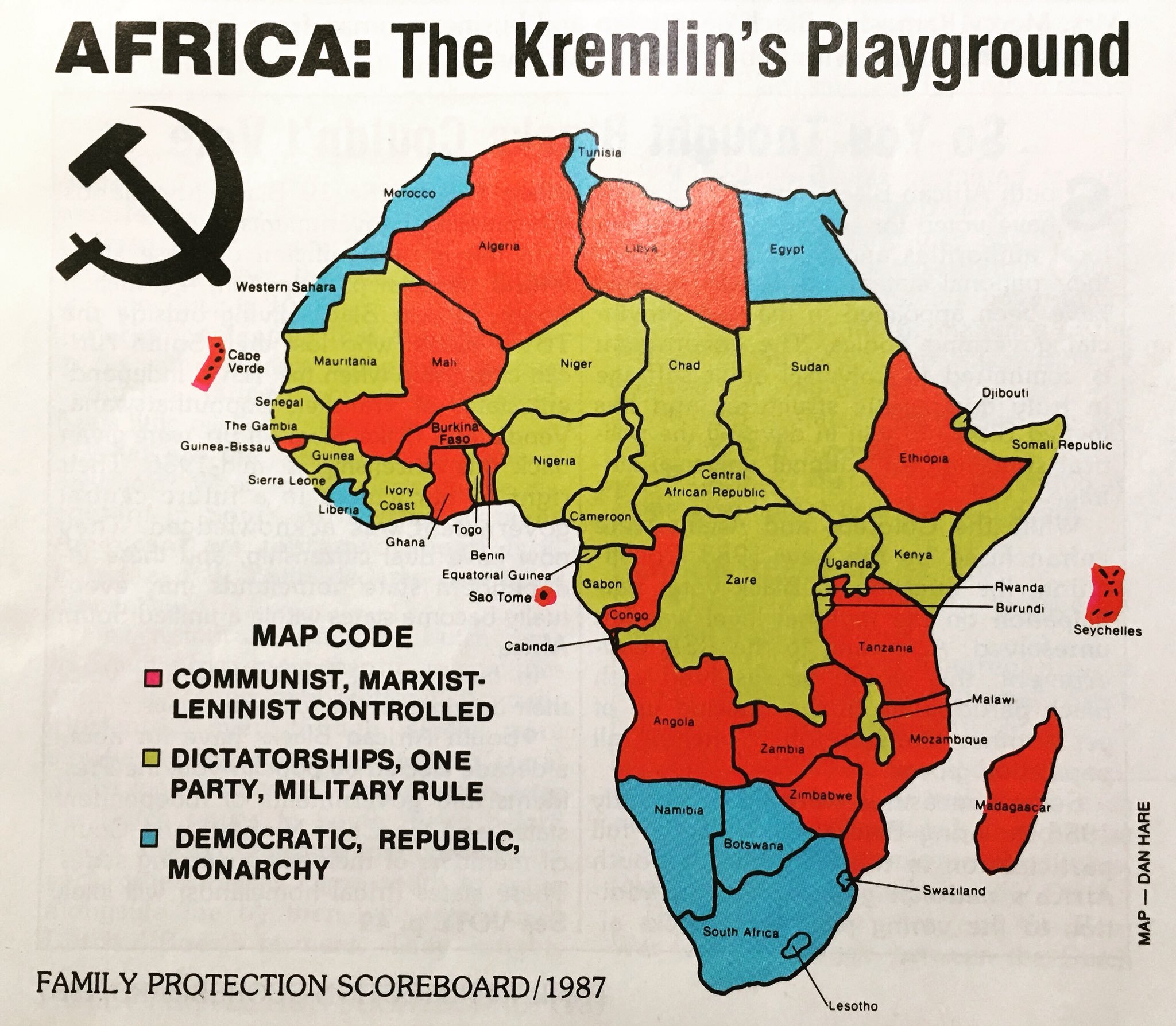
Africa: The Kremlin’s Playground (American illustration, 1987)
Text: Africa: The Kremlin’s Playground. Year: 1987. Publisher: Family Protection Scoreboard. Artist: NA. Additional Information: Pro-apartheid map from 1987 purporting to show the growing influence of communism across Africa. Communist countries are shaded red, non-communist dictatorships shaded green, and democracies, republics and monarchies shaded blue. The map was published in a special edition of the…
-
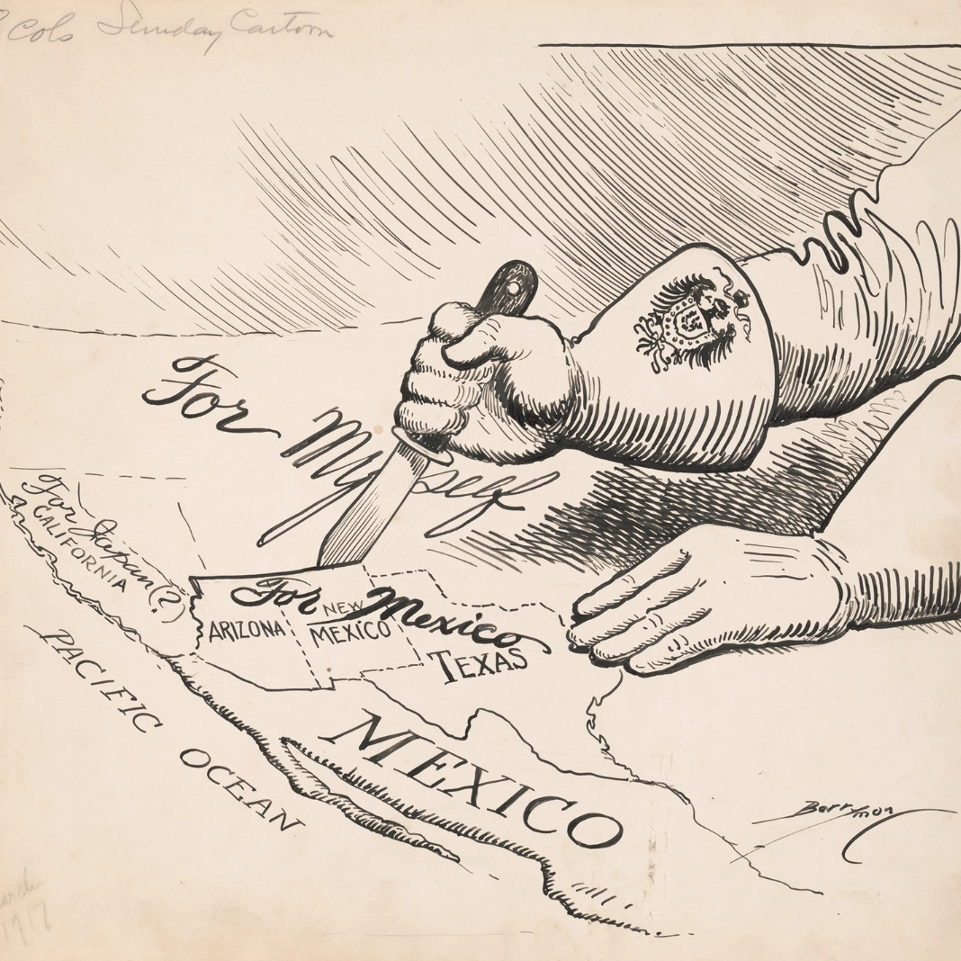
American cartoon, 1917
Text: Full transcription below. Year: 1917. Publisher: Washington Star newspaper. Artist: Clifford K. Berryman. Additional information: Cartoon shows the Kaiser’s hands carving up the United States, with Arizona, New Mexico and Texas labelled ‘For Mexico’, California labelled ‘For Japan(?)’ and the remainder labelled ‘For Myself’. The cartoon was drawn by Clifford K. Berryman and published…
-
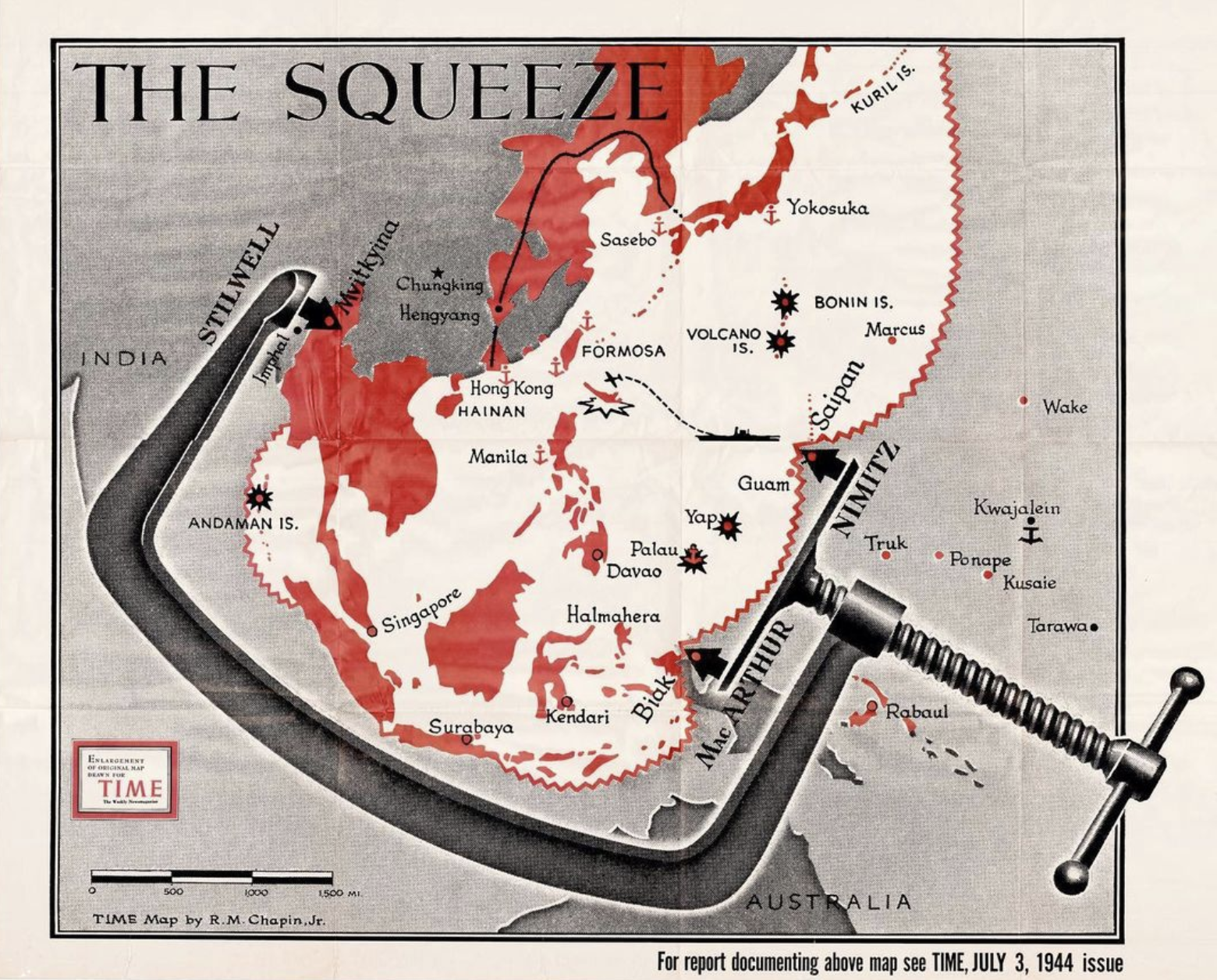
The Squeeze (American map, 1944)
Text: The Squeeze. Year: 1944 Publisher: Time magazine Artist: Robert M. Chapin. Additional information: Illustration showing the Japanese Empire being squeezed by a giant vise. One arm is labelled “Stilwell” in reference to General Joseph Stilwell, commander of the American forces in the China Burma India theatre, while the lower is labelled “MacArthur” and “Nimitz”…


